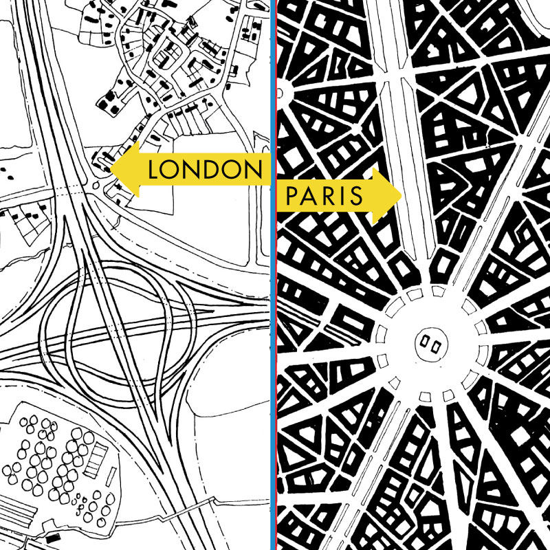
Two intersections of major roads portray distinctly different ways to handle traffic flow: a highway interchange in rural England and the Place de L’Etoile traffic circle in Paris—home of the Arc de Triomphe. Each intersection handles enormous volumes of traffic, but one design creates a great place while the other design removed a place and is now just a number on a highway map.
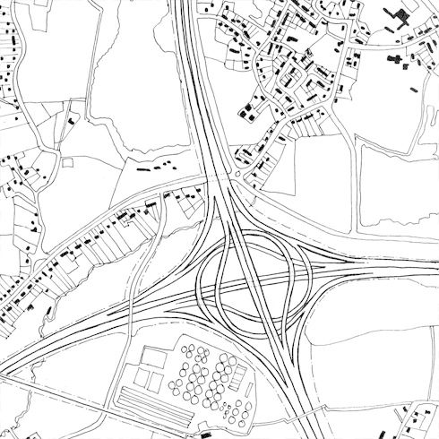
The anonymous interchange in the London countryside efficiently moves cars from one motorway to the other at high speeds, but it detaches the traveler from the place and divides the land into quarters. Before the motorway, residents of the farmhouses along the old road in the upper left corner probably walked to the village in the upper right for daily needs and carted goods to the market. Today, the water treatment plan is conveniently shielded from residential areas, but the elevated roadway has permanently severed the core of the village from the associated farmhouses. Here, transportation infrastructure has created a dead zone for pedestrians and community.
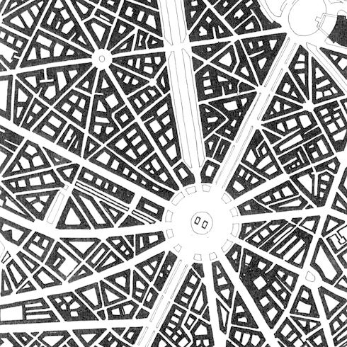
The Place de L’Etoile is quite literally a triumphant gesture celebrating the victories of an entire country at the intersection of twelve of Haussmann’s most important Parisian boulevards. While Haussmann has been vilified for destroying large swaths of medieval Paris, he took care to ensure that buildings and roadways complemented each other in the New Paris. With unified cornice lines and majestic vistas, the transportation arteries of the new city became grand outdoor rooms that encouraged pedestrians to leisurely promenade.