San Francisco Bay Trail: Risk Assessment and Adaptation Prioritization Plan (RAAPP)
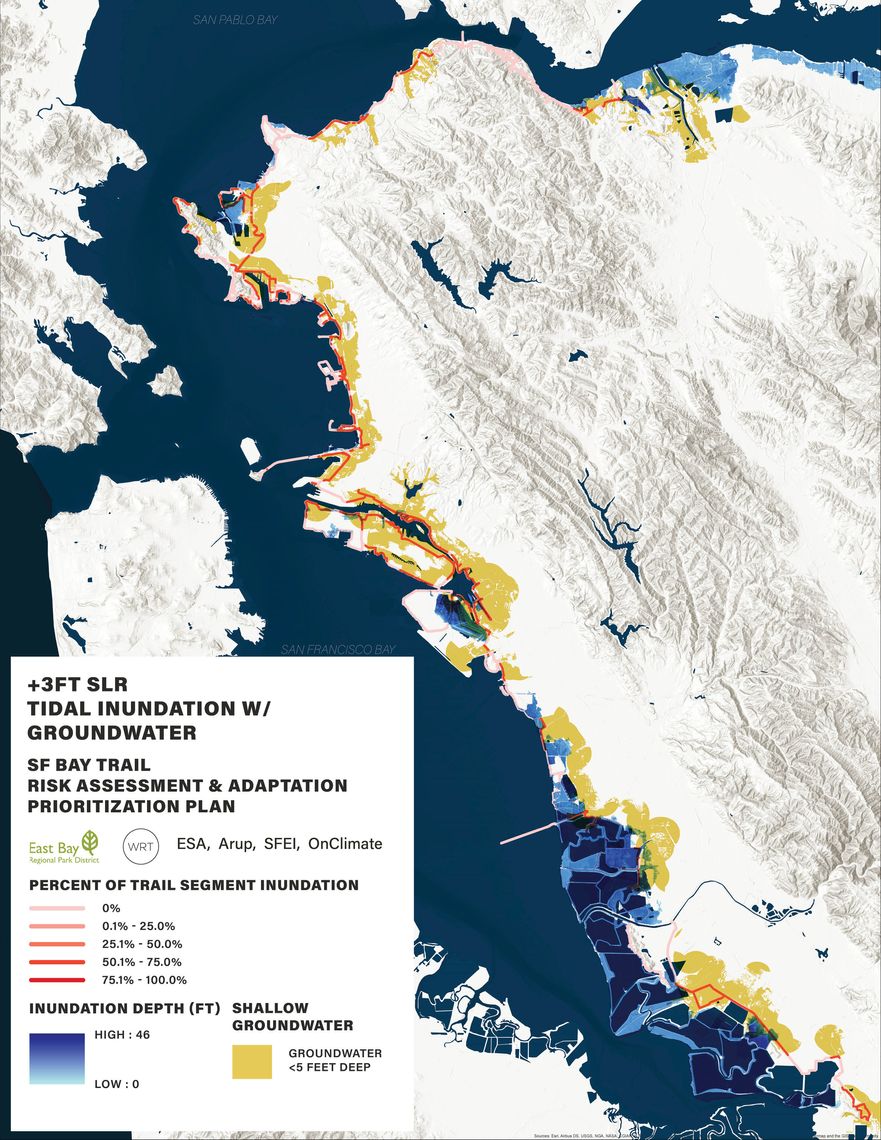
WRT led an interdisciplinary team to develop the San Francisco Bay Trail Risk Assessment and Adaptation Prioritization Plan (SF Bay Trail RAAPP) for the East Bay Regional Park District (EBRPD). This study evaluates the vulnerabilities facing the East Bay’s shoreline and assists EBRPD in prioritizing nature-based adaptation projects to provide multiple benefits for the region.
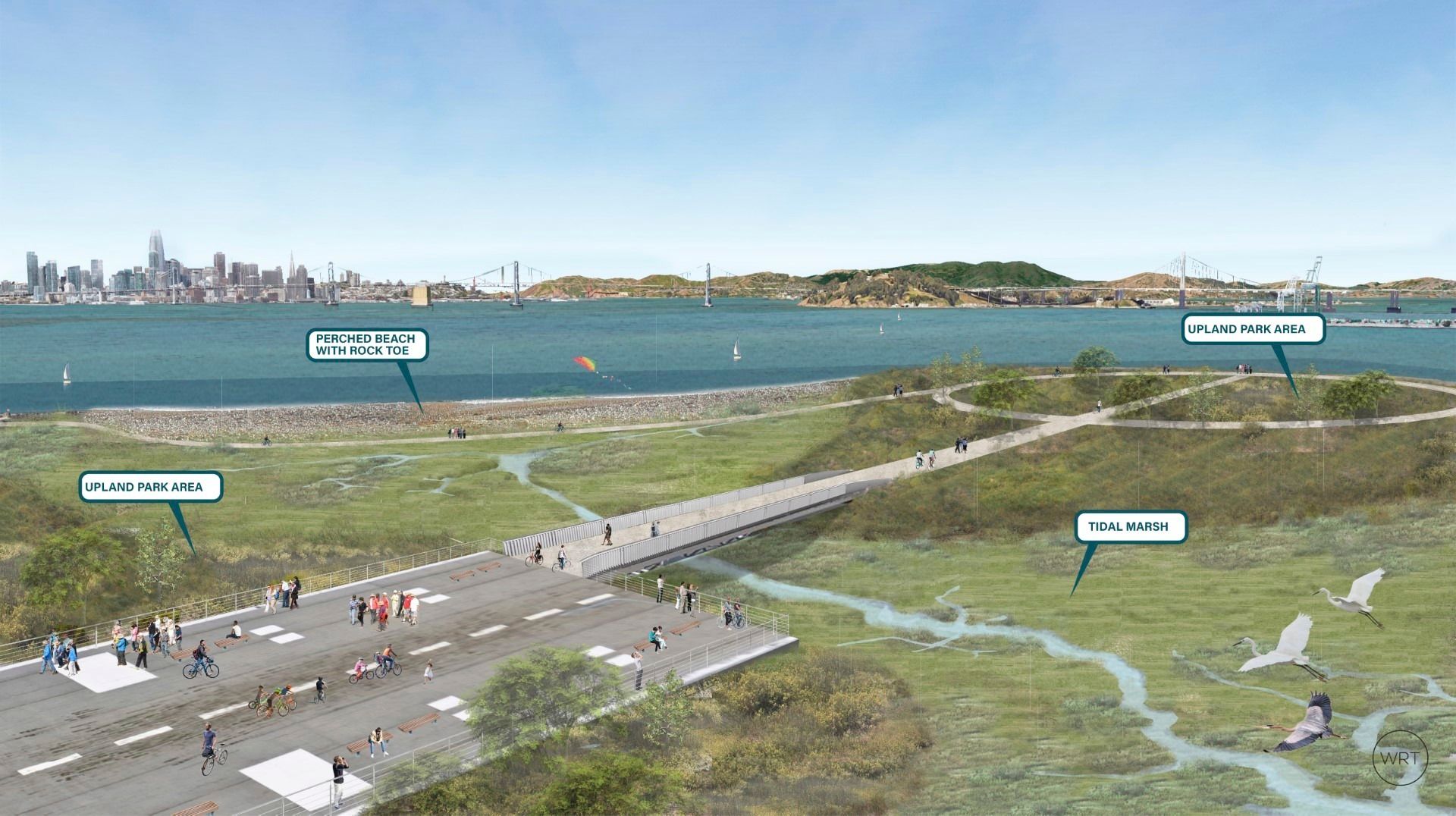
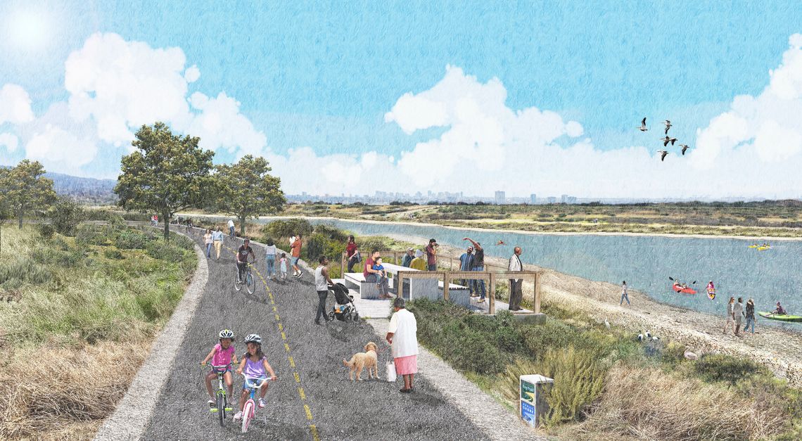
At a high level, the plan is focused on balancing our goals in the Bay related to advancing ecological restoration, recreation, critical mobility, and building important interpretive educational opportunities. The plan also narrows in on a several example projects to demonstrate how the latest techniques related to coarse beach and marsh adaptation, for example, can be implemented over time to provide shoreline access as sea levels rise. By working with a wide range of experts, from research partners to local community stakeholders, WRT and the team has developed an integrated approach to adaptation planning and design that will benefit the community and broader region over time.
RAAPP was completed in April 2021 and the East Bay Regional Park District (EBRPD) is working with project consultants and partners to implement projects identified in the plan.